Gives one a good perspective.
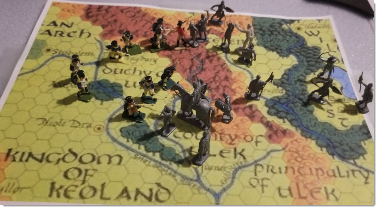
Key info on figures below:

The painted blue figures defending the Duchy of Ulek and remnants of other kingdoms forces. ( DM/Dave: French Napoleonic infantry of the line - these are actually about 45 years old! My brother - Connor and Jake's uncle - used these for many wargames) 😁
Those in grey are the Black Rune and allies, having taken over the Principality of Ulek, and County of Ulek. The Black Runes are driving North are are across into Duchy lands.

 to the North, the forces of Iuz (Cambion Daemon and his hordes are driving south.
North of the Kron Hills, the forces of Romack - Overlord of Greyhawk war with the Black Runes.
The most important force in RED (The figure actually is British solder from Napoleonic era similar to the blue French) is the RedWater Fellowship. Currently located at the GreySkull encampment on the eastern side of the mountain pass leading to the Duchy of Ulek.
No comments:
Post a Comment